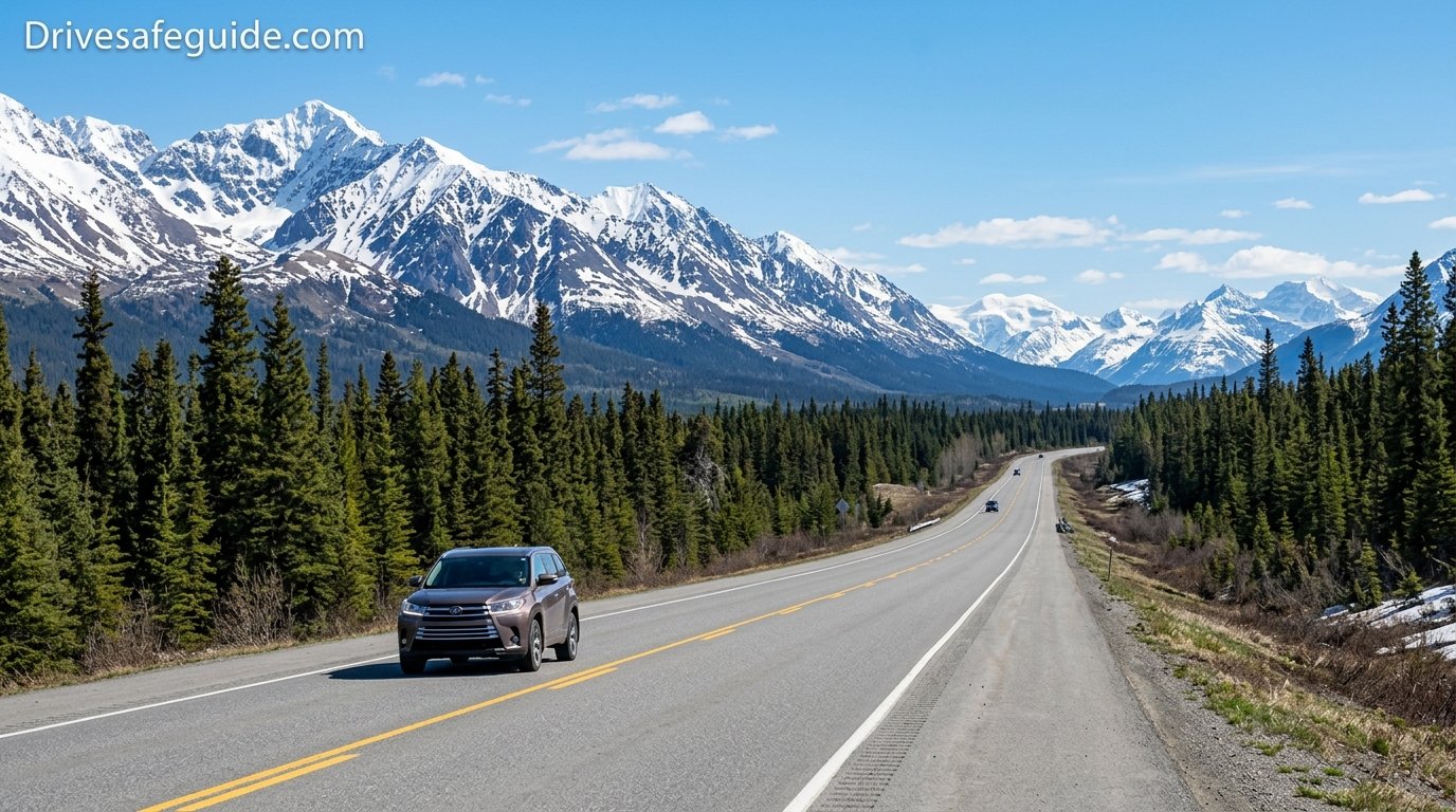
Can You Drive to Alaska? Routes, Border Rules, Costs, and What to Expect
Yes, you can, and for many travelers it is the trip of a lifetime. Here is how the drive actually works, from the border paperwork to the last gas station before the long empty stretches.
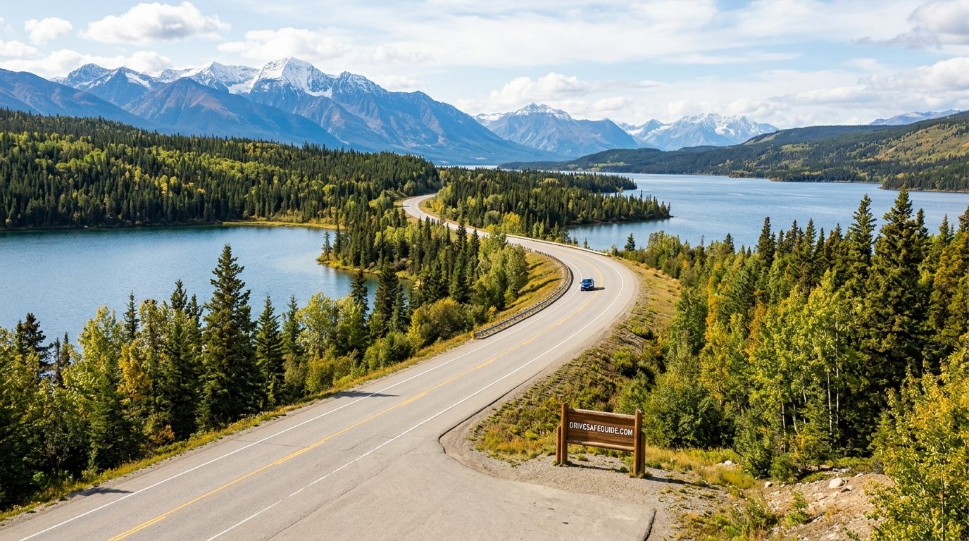
The Short Answer: Yes, You Can Drive to Alaska
You can drive to Alaska from the lower 48 states, and thousands of people do it every summer. There is one important catch that surprises first-timers: Alaska does not connect to the rest of the United States by road without passing through Canada. Every driving route goes through British Columbia, Alberta, or the Yukon, which means you will cross an international border at least twice, once going in and once coming out.
The most famous way to do it is the Alaska Highway, which starts in Dawson Creek, British Columbia, and runs roughly 1,390 miles (about 2,230 kilometers) to Delta Junction, Alaska. From there, paved highways carry you onward to Fairbanks, Anchorage, and the Kenai Peninsula. The road is fully paved today, it is maintained year-round, and it is regularly driven by ordinary passenger cars, minivans, pickup trucks, and RVs. You do not need a four-wheel-drive vehicle or a lifted truck.
That said, this is not a normal highway trip. Services can be far apart, cell coverage disappears for long stretches, weather changes quickly, and wildlife shares the road with you. None of that is a reason to stay home. It is a reason to prepare properly, and that is what this guide is for.
Who this trip suits best
The drive works well for retirees with flexible calendars, families who want a long summer adventure, remote workers who can bring a laptop along, and anyone relocating to Alaska with a carload of belongings. It is less well suited to travelers with only a week of vacation, because the round trip eats most of that time before you have even seen Denali. If your schedule is tight, consider driving one direction and shipping the car or flying home, or taking the ferry for part of the route.
It also helps to be honest about your own temperament. Some people love long driving days and find the rhythm of the road relaxing. Others get restless after four hours. Knowing which type you are will shape how many days you give yourself, how many stops you plan, and how much entertainment you bring, from podcasts to audiobooks to a playlist you actually enjoy.
Quick summary: Bring a valid passport, proof of insurance, a full-size spare tire, and a flexible schedule. Plan for at least a week each way if you want to enjoy the drive, and book summer lodging early.
If you have ever wondered whether a similar adventure is possible for another far-off destination, our breakdown of whether you can drive to Hawaii makes for a fun comparison. Alaska, thankfully, is a real road trip with a real road.
Start your planning with a printed road atlas and a travel journal. Paper maps still matter where signals fade.
Shop Alaska Road MapsWhich Route Should You Take?
There are three practical ways to reach Alaska with your own vehicle. Each trades speed, scenery, and difficulty differently, so it is worth choosing deliberately rather than just following whatever your navigation app suggests.
The Alaska Highway (the classic route)
For most drivers, this is the answer. Starting at Mile 0 in Dawson Creek, you pass through Fort St. John, Fort Nelson, Muncho Lake, Liard River, Watson Lake, and Whitehorse before crossing into Alaska near Beaver Creek, Yukon. Highway services, lodging, and repair shops are the most reliable here, and the road is the most heavily traveled. Many drivers reach Dawson Creek from Edmonton or Calgary by way of Grande Prairie, or from Montana and Idaho by driving north through Alberta.
The Cassiar Highway (the quieter alternative)
Highway 37, known as the Cassiar, runs north through British Columbia’s wild northwest and joins the Alaska Highway near Watson Lake. It is roughly 450 miles of narrower road with fewer services, more wildlife, and some of the prettiest mountain scenery on any route. It is a great way to loop one direction on the Cassiar and the other on the Alaska Highway, as long as you are comfortable with longer gaps between fuel stops.
The Alaska Marine Highway ferry (part drive, part boat)
If you would rather skip a few days of driving, state ferries carry vehicles from Bellingham, Washington, and from Prince Rupert, British Columbia, to southeast Alaska ports like Haines and Skagway. From Haines you can drive north and join the highway system. Vehicle spaces are limited and schedules change, so check current sailings and reserve early. Our guide to car ferry loading procedure explains what to expect when you drive aboard.
| Route | Best for | Main trade-off |
|---|---|---|
| Alaska Highway | First-timers, RVs, families | Busiest road, more summer traffic |
| Cassiar Highway | Scenery and wildlife seekers | Narrower, fewer services |
| Ferry plus highway | Saving driving days | Limited vehicle space, fixed schedules |
Whichever you choose, spend time with scenic byway route planning basics so you do not accidentally design a trip that is all driving and no looking out the window.
A good paper guide to the highway mileposts makes every fuel stop and viewpoint easier to find.
Find Highway GuidebooksCrossing the Border: Paperwork and Rules
The border is the part of the trip that deserves the most attention before you leave home, because a missing document can end the drive at the first booth. Requirements can change, so always confirm the current rules with the official Canadian and U.S. border agencies before you go.
What most U.S. travelers should have
- A valid passport for every traveler, including children. A passport card or enhanced driver’s license may also work at land crossings for citizens, but a passport book is the safest choice.
- Vehicle registration and proof of insurance. Ask your insurer for a Canadian non-resident insurance card, which is a simple, usually free document that proves coverage.
- Notarized letters if you are traveling with a minor who is not your own child, or if only one parent is traveling.
- Pet paperwork. Dogs generally need a current rabies vaccination certificate, and cats may be asked for one too.
- A rental agreement that permits travel to Canada, if you are not driving your own car.
Items that cause trouble
Handguns and many other firearms are heavily restricted in Canada and should not be carried across casually. Bear spray, which is labeled for use on wildlife, is generally fine, but pepper spray meant for use on people is not. Cannabis cannot cross the border in either direction, even where it is legal on both sides. Certain criminal records, including some impaired-driving convictions, can make a traveler inadmissible to Canada, so anyone with a past record should check eligibility well in advance.
Plan for the crossing back
You will cross again on the way out, and you may face questions about food, plants, and purchases. Keep receipts handy and know the rules on what you can bring back. Our guide on border crossing vehicle inspection walks through what officers may look at, and international driving permit requirements covers when a foreign license needs extra paperwork.
Tip: Keep passports, insurance cards, and registration in one easy-to-reach folder, not buried in the trunk. Border officers appreciate a smooth, organized crossing.
A slim document organizer keeps passports and paperwork in one place for both border crossings.
Shop Travel OrganizersHow Far Is It and How Long Does It Take?
Distances are the first thing people underestimate. From Seattle to Anchorage, the drive is typically somewhere around 2,300 to 2,500 miles one way, depending on the exact route. That is about 40 to 50 hours of pure driving time, and it does not count fuel stops, meals, border waits, construction delays, or the many photo stops you will inevitably make.
A realistic pace for most drivers is 300 to 450 miles per day. Speed limits on the Alaska Highway are often 90 or 100 kilometers per hour (about 56 to 62 mph), and frequent curves, hills, and road repair slow things further. Pushing for long days on this road is tiring and less safe than it looks on a map.
| Trip style | One-way days (from the Pacific Northwest) | Pace |
|---|---|---|
| Fast and focused | 5 to 6 days | Long driving days, few stops |
| Balanced | 7 to 10 days | Time for hot springs, wildlife, and viewpoints |
| Slow and scenic | 10 to 14 days | Side trips, hiking, and rest days |
Key stretches to know
- Dawson Creek to Fort Nelson: rolling boreal forest and farmland, with a long, quiet middle.
- Fort Nelson to Watson Lake: the wildest part, with mountains, Muncho Lake, and Liard Hot Springs.
- Watson Lake to Whitehorse: open Yukon country and the famous Sign Post Forest.
- Whitehorse to the Alaska border: Kluane Lake and views of the St. Elias Mountains.
- Border to Fairbanks or Anchorage: Tok, Delta Junction, and the Alaska highway system proper.
Fatigue is the quiet hazard on trips like this. Read our tips on how to stay awake while driving and consider trading drivers every two hours if you are not traveling solo.
Long days behind the wheel go easier with proper back support.
Shop Seat CushionsWhen Is the Best Time to Drive to Alaska?
Most travelers go between mid-May and mid-September. In that window, services are open, the road is clear, and daylight is generous. In midsummer, northern Alaska and the Yukon get nearly endless daylight, which makes late dinners and long scenic evenings possible but also makes it easy to forget to sleep.
Season by season
| Season | What to expect | Biggest concern |
|---|---|---|
| Late spring | Thawing roads, fewer crowds, some closed businesses | Frost heaves, patchy services |
| Summer | Full services, long daylight, warm days | Traffic, construction, mosquitoes |
| Early fall | Gold foliage, quieter roads, northern lights return | Early snow, shortened hours at lodges |
| Winter | Dramatic scenery, aurora viewing | Extreme cold, ice, many closures |
Winter driving to Alaska is possible and some experienced travelers do it, but it is a different undertaking entirely. Temperatures can drop far below freezing, daylight is short, and services thin out. If you are considering it, read our tips for driving in winter, build a proper winter car emergency kit, and review blizzard stranded survival before you commit.
Even in summer, mountain weather can change within an hour. Rain, fog, and a surprise snow flurry at higher passes are all possible, so keep layers within easy reach. Our guide to tips for driving in fog and how to drive safely in heavy rain are good primers.
If you are planning a late-summer return, watch for wildfire smoke, which can reduce visibility and air quality across large areas of the north. Our page on driving through wildfire smoke explains how to adjust your car’s ventilation and your pace.
Pack for four seasons in one day. A compact insulated layer and rain shell are worth their space.
Shop Weather LayersPreparing Your Vehicle for the Alaska Drive
A reliable car matters more here than a fancy one. A well-maintained sedan will do better than a neglected truck. Start with a full inspection at least a few weeks before departure, so there is time to fix anything that turns up. Our how to prepare your car for a road trip guide is a solid starting checklist, and the safety checklist before a road trip helps you double-check the details.
Mechanical must-dos
- Tires: good tread, correct pressure, and a full-size spare with a working jack and lug wrench. Learn how summer tire and all-season choices affect traction in cooler, wetter conditions.
- Fluids and belts: fresh oil, coolant, brake fluid, and a belt inspection. Know the serpentine belt replacement signs before one gives out in the middle of nowhere.
- Battery: have it tested, because cold mornings in the north are tough on weak batteries. See our best car battery testers and cold weather car batteries pages.
- Brakes: mountain descents are long. Review brake pad wear indicators and have worn pads replaced early.
- Windshield: gravel and chip damage are common. Consider a clear protective film and learn the rules in is it illegal to drive with a cracked windshield.
Gear for the trunk
Carry a portable jump starter such as the ones covered in our portable jump starter review, a reliable air compressor for car tires, and a basic car emergency kit. A compact car fire extinguisher and a bright emergency flashlight belong in the cabin, not buried beneath luggage.
If you drive an electric or hybrid vehicle, check EV battery range anxiety tips and hybrid vehicle maintenance. Charging infrastructure in the far north has improved but is still far thinner than in the lower 48, so route carefully.
Pros of driving your own car
- Total schedule freedom
- Room for gear, pets, and souvenirs
- Lower cost for groups and families
- Flexible stops for photos and wildlife
Cons to weigh
- Wear and tear on tires and windshield
- Risk of breakdown far from help
- Many days behind the wheel
- Border paperwork and fuel costs
A tire inflator, jump starter, and tire gauge are the three tools most worth owning before you leave.
Shop Roadside ToolsFuel, Charging, and Services Along the Way
The single most useful habit on this drive is simple: when your tank reaches about half, start looking for the next fuel stop. Stations are more common than the road’s reputation suggests, but some stretches have long gaps, and some stations close early, close for the season, or occasionally run out of fuel entirely. Treating half a tank as the new empty removes most of the stress.
Practical fuel tips
- Fuel is sold in liters in Canada, so do the math before you wince at the pump display.
- Prices tend to be higher in remote communities. Fill up in larger towns like Fort St. John, Fort Nelson, Watson Lake, and Whitehorse when it makes sense.
- Carry a credit card that works abroad and a little cash for small, remote businesses.
- Use a mileage-based planning formula: total miles divided by your car’s fuel economy tells you how many gallons you need for the round trip.
Cell service and navigation
Do not count on cell coverage between towns. Download offline maps before you leave, carry a paper atlas, and consider a satellite messenger for emergencies. Check our safe driving apps for smartphones for apps that work well without a constant signal, and mount your phone safely with the options in best car phone mounts. Anyone wanting extra peace of mind may also like our GPS tracker guide.
A dependable dash camera also helps record road conditions and incidents in remote areas. Compare options in best dash cams for car and pair it with a quality card from best SD card for dashcam.
Food, water, and supplies between towns
Small communities along the highway often have a single grocery store or a roadside cafe, and hours can be short outside summer. Carry water, snacks, and a few simple meals so a closed restaurant never becomes a problem. A cooler stocked in a larger town like Fort St. John or Whitehorse will cover most of your lunches. Keep a small stash of non-perishable food in the car, such as nuts, bars, and canned goods, along with a gallon or two of drinking water. These supplies are rarely needed, but when a road closure or a breakdown delays you for a few hours, they make the wait comfortable rather than stressful.
Repairs and tow services
Most larger towns have mechanics, but parts can take days to arrive for less common vehicles, which is one more reason to arrive with a healthy car. Roadside assistance coverage that extends into Canada is worth confirming with your insurer or auto club, since towing distances in the north can be long and expensive. Save a few emergency numbers in your phone and write them on paper as well, because a dead phone is a common companion to a dead battery.
Rule of thumb: If a station looks open and you are below half a tank, stop. You will almost never regret an extra fuel stop on this road.
A satellite messenger can send an SOS or a check-in message even when your phone shows no bars.
Shop Satellite MessengersRoad Conditions: Gravel, Frost Heaves, and Construction
The Alaska Highway is paved, but pavement in the north behaves differently. Freezing and thawing push the ground up and down, creating frost heaves, which are sudden bumps and dips that can launch a car if you hit them at speed. Crews often mark the worst ones with small orange flags. Take those flags seriously.
What to watch for
- Frost heaves and broken pavement: slow down when you see warning flags or signs, and keep a firm grip on the wheel.
- Gravel patches and construction zones: summer repair work can mean stretches of loose gravel. Reduce speed, leave extra following distance, and expect flying stones. Our guide to safe following distance rule is especially useful here.
- Dust: dry gravel sections throw up thick clouds that reduce visibility. See dust storm driving protocol for sensible tactics.
- Narrow shoulders and sharp curves: especially in the mountain sections near Muncho Lake and the Rocky Mountain foothills.
- Passing trucks and RVs: keep patient. Pull over safely when slower traffic builds behind you.
Headlights on during the day is smart practice on northern highways, because it makes you far more visible on hilly, winding roads. Know your local expectations too: our move over law requirements and highway safety tips pages are worth a skim before you leave.
Heavy rain can make gravel sections slick and mountain passes treacherous. If you feel your tires lose grip, our hydroplaning recovery steps and skid control techniques can prepare you to react calmly. Check tire pressure often, and consider digital vs analog tire gauge comparisons to pick a gauge you trust.
Finally, glare from low northern sun can be intense. Good polarized lenses help, so see our best polarized driving sunglasses and sun glare visor solutions.
A windshield protection film and a few mud flaps can save you from the chips that gravel stretches love to leave behind.
Shop Windshield ProtectionWildlife, Safety, and Staying Alert
Wildlife is one of the main reasons people make this trip, and also one of the biggest risks on the road. Moose, bison, caribou, deer, elk, bears, wolves, and foxes all show up along the highway, often at dawn and dusk. A moose collision, in particular, can be devastating because of the animal’s height and weight.
How to drive safely around animals
- Scan the ditches and tree lines, not just the pavement ahead.
- Slow down in the early morning and around dusk, and avoid driving late at night when you can.
- If you see one animal, expect more. Bison and caribou often travel in groups.
- Never approach, feed, or crowd wildlife for a photo. Stay in your vehicle for large animals, and use pull-offs safely.
- Brake firmly if needed, but avoid swerving wildly. Our guide to what to do if you hit a deer explains what to do if impact is unavoidable.
Bears and bug season
If you hike or camp, carry bear spray you can reach in seconds, store food in your vehicle or bear-proof containers, and keep a clean campsite. Mosquitoes and biting flies can be fierce in summer, so pack a good repellent and consider a head net for hiking days.
Staying alert and safe
Build rest into every day. The remoteness of the north means a driver who gets drowsy has fewer places to stop. Use rest areas, share driving, and avoid pushing late into the night just because the sun is still up. Browse tips for driving at night and long haul driver exercises to keep your body comfortable on marathon days, and consider our top picks for orthopedic car neck pillows for passengers who like to nap.
Practical readiness also covers road trip fundamentals. Our road trip safety and safe driving habits pages are good general reading.
Bear spray and a quality insect repellent are two small purchases that protect your whole trip.
Shop Bear Safety GearLodging, Camping, and Where to Sleep
Summer is peak season, and lodging along the Alaska Highway can fill quickly, especially in smaller communities with only a handful of rooms. If you have a fixed route, book key nights ahead. If you prefer a flexible trip, build in a backup plan, such as a campground or a larger town nearby.
Your main options
- Motels and lodges: comfortable and simple, found in most small towns along the way. Reserve early in July and August.
- Provincial, territorial, and state campgrounds: affordable, scenic, and often first-come. Arrive by mid-afternoon to claim a spot.
- RV parks: hookups and amenities for motorhome and trailer travelers.
- Car camping: sleeping in your vehicle is a classic road trip move. Read car camping conversion tips and check is it illegal to sleep in your car to understand the rules in different places.
Hot springs at Liard River, quiet lakeside lodges, and small-town cafes are the kind of stops that turn a long drive into a story worth telling. If you will drive an RV or pull a trailer, review trailer hitch classes explained and rooftop cargo carrier safety to make sure your setup is both legal and safe.
Traveling with pets
Many travelers bring dogs along. Bring a rabies certificate, plenty of water, and a secure restraint. Our guide to car ride with dog and the data in pet restraint crash test ratings will help you choose a harness or crate. Never leave a pet unattended in a parked car, even on a cool day.
Finally, if you plan to see national parks and public lands on the Alaska side, check national park vehicle passes to see whether a pass could save money.
If you plan to camp, a reliable tent, sleeping bag, and headlamp make remote nights comfortable.
Shop Camping EssentialsWhat Does It Really Cost to Drive to Alaska?
Costs vary widely depending on your vehicle, group size, and comfort level, so it helps to think in categories rather than a single price tag. The big line items are fuel, lodging, food, and a repair buffer. Border-related costs, such as an insurance card, are usually small by comparison.
| Cost category | What drives the price | How to save |
|---|---|---|
| Fuel | Miles, fuel economy, and remote pricing | Fill up in larger towns, drive steadily |
| Lodging | Season, booking date, camping vs motels | Mix campgrounds with motel nights |
| Food | Restaurants vs groceries | Stock a cooler, buy supplies in bigger towns |
| Maintenance | Vehicle age and pre-trip condition | Do a thorough check before departure |
| Extras | Park fees, ferries, tours, souvenirs | Choose a few highlights, skip the rest |
To estimate fuel, divide your round-trip miles by your car’s miles per gallon, then multiply by a realistic average fuel price. Add a healthy cushion, because Canadian prices and the exchange rate shift. Many travelers also budget a repair fund for the unexpected, such as a replacement tire or a windshield chip repair.
Driving versus flying and shipping
Driving to Alaska rarely beats flying on pure cost for a solo traveler, but it wins for anyone moving, bringing a lot of gear, or wanting the journey itself. For families, splitting fuel and lodging across several people often makes the drive competitive, and you will have your own vehicle on arrival, which is a major advantage in a state where public transit is limited.
Hidden costs people forget
A few expenses tend to sneak up on first-time travelers. Mobile roaming charges in Canada can be steep, so check your plan or add a temporary international package. Currency exchange fees on card purchases add up over many small transactions, so a card without foreign transaction fees is worth having. Tire wear is real on a trip of this length, and an oil change somewhere along the way is a sensible line item. Finally, souvenirs, park entry fees, and the occasional splurge on a guided flightseeing tour or glacier cruise can easily double the cost of a quiet day, so decide ahead of time which experiences are truly worth it.
Ways to keep the trip affordable
Traveling in the shoulder seasons, in late May or early September, often means cheaper lodging and fewer crowds. Cooking some meals from a cooler or camp stove saves a surprising amount over two or three weeks. Splitting driving and costs with a travel partner helps, and so does keeping your speed steady, since smooth driving improves fuel economy over thousands of miles. Most of all, avoid the expensive mistake of skipping maintenance before departure. A hundred-dollar inspection is far cheaper than a tow from the middle of the Yukon.
If you want to trim costs, consider budget-friendly upgrades from budget car gadgets biggest upgrades, and review uninsured motorist coverage so you know your insurance is up to the job.
An insulated cooler and a few reusable containers cut food costs and keep snacks handy between towns.
Shop Road Trip CoolersA Sample Itinerary and Smart Stops
Use this as a flexible template, not a rigid schedule. It assumes a start in the Pacific Northwest and a comfortable pace of roughly 400 miles per day, with a rest day built in. Adjust it based on your starting point and your appetite for stopping.
- Day 1: Drive from the Pacific Northwest toward central or northern British Columbia or Alberta, aiming to reach Grande Prairie or Dawson Creek by evening.
- Day 2: Dawson Creek to Fort Nelson. Take the classic Mile 0 photo, and fuel up in Fort St. John.
- Day 3: Fort Nelson to Liard River Hot Springs, passing Muncho Lake. Soak in the hot springs before dinner.
- Day 4: Liard River to Whitehorse by way of Watson Lake and its Sign Post Forest.
- Day 5: Whitehorse to Beaver Creek, driving beside Kluane Lake and the St. Elias Mountains.
- Day 6: Cross the border into Alaska. Continue to Tok and Delta Junction, then on to Fairbanks.
- Day 7: Fairbanks to Anchorage, with a possible detour toward Denali National Park.
Worthwhile side trips
- Dawson City and the Top of the World Highway from Tok, a seasonal route with sweeping ridgeline views.
- Skagway and the Klondike Highway for a dramatic mountain and gold-rush detour.
- Kluane National Park and Reserve for hiking, glaciers, and wildlife.
- Denali National Park for wildlife and views of North America’s tallest peak.
- The Kenai Peninsula for fishing, glaciers, and coastal scenery south of Anchorage.
For general inspiration on long journeys, our cross-country driving checklist, road trip essentials checklist, and roadside attraction stops are fun to browse. If you are building a vehicle emergency plan for remote country, desert breakdown water rationing offers principles that translate surprisingly well to any remote stretch.
A compact dash cam captures the scenery and the unexpected, and doubles as evidence if something goes wrong.
Shop Dash CamsFrequently Asked Questions
Can you drive to Alaska without going through Canada?
No. There is no road connection between Alaska and the rest of the United States that stays entirely within U.S. territory. Driving routes pass through Canada, while the Alaska Marine Highway ferry offers a way to bring your vehicle by water instead.
Do I need a passport to drive to Alaska?
For most travelers, yes. A valid passport is the safest document for crossing into Canada and returning to the United States. Some citizens can use alternative documents at land crossings, but you should confirm current requirements with the border agencies before you leave.
How long does it take to drive to Alaska?
From the Pacific Northwest, expect roughly 5 to 6 days one way if you drive steadily, or 7 to 10 days for a more relaxed pace. Longer trips from farther south or east will take more time.
Is the Alaska Highway paved?
Yes, the Alaska Highway is paved along its length. Expect frost heaves, patched pavement, and occasional gravel sections in work zones, but ordinary passenger vehicles can handle it with careful driving.
Can I drive an electric vehicle to Alaska?
It is possible, but it requires careful planning because fast chargers are far fewer and farther apart than in the lower 48. Map your charging stops in advance, expect slower progress, and read up on range planning before committing.
Is it safe to drive to Alaska alone?
Many people do it, and it can be safe with preparation. Carry a satellite communicator, share your itinerary with someone at home, keep a well-stocked emergency kit, and avoid pushing through fatigue.
What is the best time of year to drive to Alaska?
Mid-May to mid-September offers the best mix of open services, clear roads, and long daylight. Winter driving is possible but demands cold-weather equipment and experience.
Will my cell phone work on the way?
Only in and near towns. Large portions of the route have no coverage, so download offline maps, carry a paper atlas, and consider a satellite messenger. Check your plan for Canadian roaming costs before you leave.
Do I need special tires or a four-wheel-drive vehicle?
Not in summer. A reliable car with good tires, a full-size spare, and regular maintenance is enough. Winter trips call for appropriate winter tires and more equipment.
Can I bring my dog across the border?
Usually yes, with a valid rabies vaccination certificate and a calm, well-restrained pet. Always confirm the current pet entry rules for both countries before you travel.
How much gas do I need to carry?
Most drivers do not need spare fuel cans on the main highway if they fuel up regularly. Treat half a tank as your signal to refuel, and consider a small, approved container only if you plan to explore remote side roads.
What should I do if my car breaks down in a remote area?
Stay with your vehicle, make yourself visible, and use a satellite messenger or phone if coverage exists. Passing traffic is common on the main highway in summer, and many drivers will stop to help. Our LED road flares guide covers a simple way to signal for help.
Conclusion: The Road to Alaska Is Open
So, can you drive to Alaska? Absolutely. It takes more planning than a normal road trip, and it asks you to respect distance, weather, wildlife, and a border crossing, but none of it is out of reach for a prepared driver in an ordinary vehicle. The reward is a drive through some of the most dramatic wild country in North America, with hot springs, mountain lakes, wildlife, and an enormous sky waiting at every turn.
Start with the basics: confirm your passport and insurance, service your vehicle, pack a solid emergency kit, and give yourself enough days to enjoy it. Build in margin for weather and construction, keep your tank above half, and trade the urge to hurry for the pleasure of the journey. Do that, and the long road north will be remembered as the best part of the trip rather than the part that stood between you and Alaska.
Ready to get your car and your gear in shape? Our best car safety tools and best driving tips pages are a great next stop.
Gather your road trip essentials in one place and head north with confidence.
Shop Road Trip Essentials