Planning the Perfect Scenic Byway Route for Your Next Road Trip
A practical, mile-by-mile approach to choosing, timing, and driving a scenic byway — from picking the right designation to knowing when to close the itinerary and just watch the road.
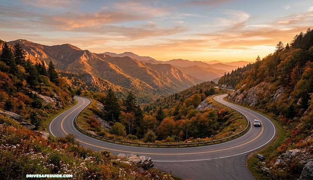
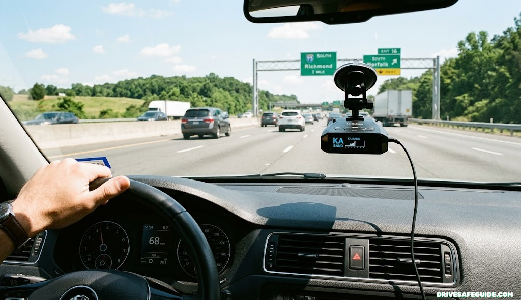
A scenic byway rewards a completely different kind of planning than a highway road trip. On an interstate, the plan is mostly logistics: how fast can you get from A to B. On a byway, the road itself is the destination, which means the planning question flips — how do you build a route and a schedule that actually let you experience the road instead of just surviving it. That distinction sounds small, but it changes almost every decision that follows, from how many miles you put on the odometer each day to what you pack in the trunk before you leave.
This guide walks through the full process of planning a scenic byway route, in the order most travelers actually need it: understanding what a byway is, narrowing down which one fits your trip, mapping out realistic timing, prepping the vehicle, and building in enough slack to actually enjoy it. Along the way you’ll find a few internal resources from DriveSafeGuide that go deeper on specific pieces of the puzzle, so you can treat this as the hub and branch out where you need more detail.
None of the steps below require specialized gear or advanced planning software. What they require is a willingness to plan the trip around the road’s actual pace rather than the pace you’d default to on a highway, and enough lead time to check the details — closures, fuel gaps, weather windows — that generic mapping apps routinely miss on rural corridors. Work through the sections in order the first time, then come back to whichever ones matter most once you already know your destination.
What Makes a Scenic Byway Different From a Regular Road Trip Route
A scenic byway is not simply “a pretty road.” In the United States, the term has a formal meaning attached to it. Routes are nominated and reviewed against six intrinsic qualities: scenic, historic, cultural, recreational, natural, and archaeological value. A road only needs to score exceptionally in one of these categories to earn a designation, which is part of why byways vary so widely in character — some are defined by geology, others by a preserved historic corridor, and others by the culture of the communities the road passes through.
That distinction matters for planning because it tells you what kind of experience to expect before you ever turn the key. A byway recognized for historic value might route you through small towns with museums and markers worth twenty minutes each, while one recognized for scenic or natural value might have almost no built infrastructure at all — just pull-offs, overlooks, and long stretches where the landscape is the entire point. Reading the designation reason for a route, which is usually published by the managing state or federal agency, is one of the fastest ways to calibrate expectations before you build a day-by-day plan.
The practical upshot is that byways are engineered — sometimes literally, sometimes just by convention — to be driven slower. Speed limits tend to run lower than comparable highways, curves are tighter, and the shoulder pull-offs are frequent by design, not as an afterthought. Treating a byway like a stretch of interstate you need to clear quickly usually means missing the reason the road was designated in the first place, and it can also be a genuine safety issue, since these roads are not built for the kind of speed differential that causes rear-end collisions at overlooks and viewpoints.
Byway vs. Ordinary Scenic Route
Plenty of roads are scenic without being an official byway, and plenty of official byways run through stretches that are fairly plain in between the highlights. The designation is a useful planning signal — it usually means visitor infrastructure, interpretive signage, and maintained pull-offs exist — but it is not a guarantee that every mile will be dramatic. Cross-referencing a byway’s official route map against satellite imagery before committing an entire day to it is a small step that saves real disappointment.
Regional variation adds another layer worth understanding early. A byway in a coastal state may lean heavily on cultural and historic value, weaving through fishing villages and lighthouse districts, while a byway through a mountain range further inland is more likely to be recognized primarily for natural and recreational value, with the built environment mostly absent. Neither pattern is better than the other, but they call for different expectations, different footwear, and in some cases different vehicles, so it’s worth reading a short regional overview of the byway before locking in dates.
Defining Your Road Trip Goals Before You Open a Map
The single biggest planning mistake is opening a map before deciding what the trip is actually for. Byway trips tend to fall into a few recognizable categories, and each one points toward a different kind of route and pace. A photography-driven trip wants to be near overlooks at sunrise and sunset, which means shorter driving windows and longer stationary time. A trip built around visiting a specific national park or landmark treats the byway as the approach, with most of the time budget spent at the destination rather than the drive itself. A pure driving trip, where the road is the whole point, wants long uninterrupted stretches and minimal detours.
Write the goal down in one sentence before doing anything else. “See fall color in the mountains,” “drive the coast slowly with my partner,” and “show the kids a national park while covering ground efficiently” are three different trips that would justify three different byways, three different daily mileage caps, and three different lodging strategies. Skipping this step is how people end up with an itinerary that technically includes a famous byway but doesn’t actually deliver the experience they wanted from it.
It also helps to be honest about who is in the car. A solo trip built around long driving days and minimal stops looks nothing like a family trip with young kids who need frequent breaks, or a trip with an older relative who needs shorter driving stretches and more comfortable overnight stops. If mobility, motion sensitivity, or medical needs are a factor for anyone traveling, it’s worth reviewing DriveSafeGuide’s guide on road trip essentials early, since several packing and pacing decisions change based on who is riding along.
Budget is worth folding into the same conversation, since a byway trip’s cost structure looks different from a straightforward highway drive. Fuel efficiency drops on winding, hilly roads compared to flat interstate cruising, trip length tends to stretch as stops multiply, and gateway-town lodging often carries a premium during peak season precisely because supply is limited. Sketching a rough daily budget before finalizing the route, rather than discovering it once you’re already committed to a multi-day corridor, avoids having to cut the trip short partway through for reasons that had nothing to do with the road itself.
Signs a Byway-Heavy Trip Fits
- You want the drive itself to be a highlight, not just transit time
- Your group is comfortable with slower, curvier roads
- You have flexible dates that can shift around weather or closures
Signs a Direct Route Fits Better
- You’re on a tight, fixed arrival deadline
- Anyone in the car has motion sensitivity on winding roads
- Your vehicle has known reliability concerns for remote driving
How to Choose the Right Scenic Byway for Your Timeline
Once the goal is defined, the next filter is time. Byways range from short, self-contained loops that take an afternoon to multi-day corridors that stretch several hundred miles. Matching the byway’s length to the actual time available, rather than the time you wish you had, prevents the most common source of byway-trip stress: running out of daylight or patience halfway through a route that was never realistic for the schedule.
A useful way to estimate is to take the byway’s official mileage and divide it by a driving pace far slower than you’d use on a highway — often 25 to 35 miles per hour average once stops are factored in, not the posted speed limit. A 120-mile byway at that pace, with a reasonable number of stops, can easily fill a full day. Trying to combine two or three separate byways in a single day, which is a common temptation when looking at a map that makes the roads look close together, usually backfires once the actual driving time and stop time are added up.
Matching Byway Character to Trip Style
Coastal byways tend to have dense clusters of short pull-offs close together, which means frequent stopping and slower net progress even though the posted speeds might be higher than a mountain road. Desert and plateau byways often have the opposite pattern — long stretches with almost nothing, punctuated by a small number of major stops that deserve extended time. Mountain byways sit in between, with elevation changes that slow average speed regardless of how many times you actually stop the car. Knowing which pattern your chosen byway follows helps you build a schedule that matches its actual rhythm instead of a generic one.
If your dates are flexible, checking whether a state-designated (rather than federally designated) byway nearby covers similar terrain with a fraction of the traffic is worth the extra research time. State byway lists are usually maintained by the state’s department of transportation or tourism office and are less crowded precisely because they get less national attention.
| Trip Length | Good Byway Fit | Typical Daily Pace |
|---|---|---|
| Half day (3–4 hrs) | Short loop or spur byway near a single destination | 40–70 miles |
| Full day | Single mid-length byway with a handful of major stops | 80–150 miles |
| Weekend (2–3 days) | One long byway or two connected shorter ones | 100–150 miles/day |
| Week or more | Multi-byway corridor across a region | 120–180 miles/day |

Keep Your Route Loaded Even Without Signal
A dedicated GPS unit with offline maps is cheap insurance on byways where cell service disappears for hours at a time.
Check Prices on AmazonReading Byway Designations: National Scenic Byways, All-American Roads, and State Routes
Understanding the tier of designation a road carries helps set expectations before you commit a day of your trip to it. In the federal America’s Byways program, roads are recognized as either National Scenic Byways or the higher tier, All-American Roads. An All-American Road needs to meet a stricter bar — it must be considered a destination unto itself, not simply a route that connects other destinations, and it must score exceptionally on at least two of the six intrinsic qualities rather than just one.
Below the federal tier, most states run their own scenic byway or scenic highway programs with their own criteria, and these routes make up the majority of what’s actually out there. State-level byways don’t always come with the same density of interpretive signage or visitor infrastructure, but many are just as scenic and see dramatically less traffic, which can be the deciding factor for travelers who want the experience without the crowds.
Why the Tier Matters for Planning
Higher-tier designations generally correlate with better-maintained pull-offs, more frequent restrooms, and more reliable cell coverage near towns, simply because more tourism infrastructure tends to follow the higher-profile designation. Lower-tier or state-only byways can be just as scenic but may require more self-sufficiency — more fuel range, more food and water on hand, and less reliance on finding services along the way. Neither tier is inherently the “right” choice; the decision comes down to how much infrastructure your trip actually needs versus how much solitude you want.
| Designation | Managed By | Typical Infrastructure |
|---|---|---|
| All-American Road | Federal Highway Administration | Extensive signage, visitor centers, frequent pull-offs |
| National Scenic Byway | Federal Highway Administration | Good signage, regular pull-offs, moderate visitor infrastructure |
| State Scenic Byway | State DOT or tourism agency | Variable; often minimal but well maintained |
| Locally recognized route | County or municipal authority | Minimal formal infrastructure |
Mapping Fuel Stops, Charging Stations, and Rest Points Along Remote Stretches
Long stretches of scenic byway can run 60, 80, or even over 100 miles without a fuel station, and that gap is exactly the kind of detail that generic mapping apps tend to underrepresent, since they’re usually optimized for the fastest route rather than the safest fuel plan. Before departure, it’s worth manually marking every known fuel stop along the route, noting which ones have had recent closures or limited hours, and treating any stretch longer than your vehicle’s comfortable range as a hard planning constraint rather than a minor inconvenience.
Electric vehicle drivers face a sharper version of this problem, since fast chargers are far less evenly distributed along byways than gas stations, and elevation changes on mountain byways can meaningfully affect real-world range in ways that flat highway range estimates don’t capture. Planning charging stops with a buffer — arriving with more charge in reserve than you think you need — is the standard practice among experienced EV road trippers on rural byway corridors.
Rest Stops and Fatigue Management
Byways demand more concentration per mile than highways, thanks to curves, wildlife crossings, and constantly shifting sightlines, which means fatigue can build faster than the mileage alone would suggest. Building in a real rest stop, not just a bathroom break, every couple of hours helps keep concentration sharp on a road where a moment of inattention has less margin for error than a straight interstate lane. If you’re planning to drive during low-light hours anywhere along the route, DriveSafeGuide’s night driving safety checklist is worth reviewing, since headlight glare and wildlife visibility both change significantly on unlit rural roads.
It’s also worth pairing your fuel-and-rest map with a general safety kit review before departure. A byway that runs through repeater-free canyon country is not the place to discover your spare tire is flat or your jump starter battery is dead. DriveSafeGuide’s guide on how to build a car safety kit covers the baseline items worth having before any remote drive, byway or otherwise.

Don’t Let a Dead Battery End the Trip Early
A compact lithium jump starter takes up almost no trunk space and covers one of the most common roadside failures on remote routes.
Check Prices on AmazonBuilding a Realistic Daily Mileage and Time Budget
Once the route is chosen, the next step is turning it into an actual day-by-day schedule, and this is where most first-time byway trips go wrong. Standard trip-planning apps calculate drive time based on posted speed limits and normal traffic conditions, which produces numbers that are consistently optimistic for byway driving. A route that a map app estimates at three hours can easily take five or six once you account for slower average speeds, photo stops, and the simple fact that you’ll want to actually get out of the car at the overlooks.
A more reliable approach is to build the schedule backward from sunset rather than forward from a wake-up time. Decide what time you want to arrive at your final stop for the day — with enough daylight left to set up camp or check into lodging without rushing — and work backward through the planned stops to see whether the math actually holds. If it doesn’t, the answer is almost always to cut a stop or shorten the day’s distance, not to compress the time spent at each remaining stop.
A Simple Time-Budget Method
- Note the byway’s total mileage for the day’s segment.
- Estimate driving time at 25–35 mph average, not the posted limit.
- Add 15–30 minutes for each planned stop, more for a meal or a trailhead.
- Add a 30–60 minute buffer for the unplanned stop you will inevitably make.
- Compare the total against available daylight and adjust before you leave, not on the road.
This kind of buffer-first planning pays off most on days that also involve navigating unfamiliar towns or looking for lodging on arrival. If your byway trip touches a dense urban stretch at either end, it’s worth reviewing timing resources like DriveSafeGuide’s guide to driving an island loop with realistic timing, which walks through the same backward-planning logic applied to a different kind of route.
Packing and Vehicle Prep for Long Stretches Without Services
A byway trip asks more of a vehicle than a comparable interstate drive, even when the total mileage is similar. Elevation changes, lower-quality pavement on some older byway segments, and long gaps between service stations mean pre-trip vehicle prep deserves more attention than it would for a straightforward highway run. A pre-departure check should cover tire condition and pressure, fluid levels, brake condition, and battery health, ideally a week or two out from departure so there’s time to address anything that turns up.
DriveSafeGuide’s guide on preparing your car for a road trip covers the full pre-departure checklist in detail, and it’s worth treating as a mandatory step rather than an optional one for byway driving specifically, since the cost of a breakdown scales with how far you are from help.
What to Pack Beyond the Basics
Beyond the standard road trip packing list, byway-specific trips benefit from a few additions: paper maps as a non-electronic backup, extra water beyond what feels necessary, a physical first aid kit, and layered clothing regardless of season, since elevation changes on mountain byways can shift the temperature by twenty degrees or more between the trailhead and the summit overlook. Travelers whose routes cross international borders or involve unfamiliar licensing requirements should also review DriveSafeGuide’s overview of international driving permit requirements well before departure, since these can take weeks to process.
Worth Packing for Any Byway Trip
- Printed or downloaded offline maps of the full route
- A basic tire repair kit and portable inflator
- Extra water and shelf-stable food beyond your estimated needs
Common Packing Mistakes
- Relying entirely on phone-based navigation with no offline backup
- Assuming fuel and food will be available “somewhere along the way”
- Packing for the valley temperature and ignoring the pass elevation

Check Tire Pressure Before Every Elevation Change
A compact tire inflator with a built-in gauge makes it easy to adjust pressure as temperature and altitude shift along a byway.
Check Prices on AmazonChoosing Lodging and Camping Along a Byway Corridor
Lodging along scenic byways tends to concentrate in small gateway towns, which means availability can be far tighter than the same search would show in a major city, particularly during peak season or around holiday weekends. Booking the first and last nights of the trip in advance, while leaving one or two middle nights flexible, is a common middle ground between a fully planned itinerary and the freedom to adjust based on weather, energy levels, or a stop that ran long.
Camping along a byway opens up more spontaneity but comes with its own planning requirements — checking whether campgrounds are first-come-first-served or reservation-only, confirming seasonal closure dates, and understanding dispersed camping rules if the route passes through national forest land. Travelers converting a vehicle for overnight use should review DriveSafeGuide’s guide on car camping conversion basics before relying on the vehicle itself as a sleeping option for multiple nights.
Balancing Structure and Flexibility
A fully booked itinerary removes stress around finding a room but locks the trip into a fixed pace regardless of what the road actually offers that day. A fully unplanned approach maximizes flexibility but risks arriving in a gateway town during a sold-out weekend with no backup. Most experienced byway travelers land somewhere in the middle: anchor points booked, middle days flexible, and a mental fallback plan — a nearby town twenty minutes off-route — in case the primary option falls through.
| Lodging Style | Best For | Booking Lead Time |
|---|---|---|
| Gateway town hotel/motel | Comfort, reliable amenities, quick resupply | Weeks to months ahead in peak season |
| Reservation campground | Nature immersion with basic facilities | Weeks ahead for popular sites |
| Dispersed/backcountry camping | Maximum flexibility and solitude | Same day, with land-use rules checked ahead |
| Vehicle/car camping | Spontaneous, low-cost overnight stops | Minimal, if legal parking is confirmed |
It’s worth noting that lodging near a byway’s most famous stretch is often the priciest option, while a town twenty or thirty minutes off the main corridor can offer comparable quality for meaningfully less, at the cost of a short drive back to the route each morning. For travelers on a tighter budget, that tradeoff is frequently worth making, particularly on multi-day trips where the savings compound across several nights.
Safety Considerations for Mountain Passes, Coastal Roads, and Desert Byways
Different byway terrain types carry different risk profiles, and building a route without accounting for them is one of the more avoidable planning gaps. Mountain passes bring elevation-related engine and brake behavior, narrow shoulders, and rapid weather changes. Coastal byways bring fog, high winds along exposed cliffside sections, and the temptation to watch the view instead of the road. Desert byways bring heat management, longer gaps between services, and the risk of flash flooding in normally dry washes during storms.
Descending a long mountain grade requires deliberate brake management to avoid brake fade, a genuine risk on multi-mile descents that many drivers underestimate until it happens. DriveSafeGuide’s comparison of brake fade versus hydraulic failure is worth reading before any byway with sustained elevation loss, since recognizing the difference in the moment changes how you should respond.
Wind, Fog, and Visibility on Exposed Roads
Coastal and high-plateau byways are especially prone to sudden crosswinds that can push a vehicle, particularly a taller SUV or a vehicle towing a trailer, toward the shoulder or centerline without warning. Reviewing DriveSafeGuide’s guide on driving in high winds before a coastal route gives you a concrete plan rather than reacting in the moment. Fog is a related risk on the same terrain, and the strategies in DriveSafeGuide’s fog driving guide apply directly to marine-layer conditions common on coastal byways in the morning hours.
General defensive driving principles matter more on byways than on highways, since the margin for error is smaller and the consequences of a mistake — a narrow shoulder, a steep drop, oncoming traffic on a blind curve — tend to be more severe. DriveSafeGuide’s overview of defensive driving habits is a useful refresher for anyone who has spent most of their recent driving on wide, predictable interstates.
Wildlife crossings deserve a specific mention, since byways cutting through forested or open range terrain often see far more animal activity near the road than a comparable highway would, particularly around dawn and dusk. Scanning the shoulders well ahead rather than only the lane directly in front of the vehicle, and easing off the accelerator through known crossing zones marked by signage, reduces the chance of a sudden encounter turning into an unavoidable collision. Slower byway speeds already help here, which is one more reason resisting the urge to speed up on an empty-looking stretch is worth the extra few minutes it costs.
Weather and Seasonal Timing for Scenic Byway Travel
Timing has an outsized effect on the byway experience compared to a normal road trip, because so much of the appeal is tied to seasonal conditions that a highway drive would be indifferent to. Fall color, spring wildflower blooms, and clear winter mountain air are all narrow windows, and missing them by even a couple of weeks can mean a meaningfully different trip than the one you planned around. Checking historical timing data for the specific region, rather than assuming a season applies uniformly across a whole state, produces a far more accurate plan.
High-elevation byways commonly close for the winter, sometimes for five or six months at a stretch, and reopening dates shift from year to year based on snowpack. Confirming current status directly with the managing agency shortly before departure, rather than relying on a general “usually open by” date found in an older article, avoids arriving to find a gate closed with no detour.
Weather Along the Way, Not Just at the Destination
It’s easy to check the forecast for the final destination and forget that a byway passes through several distinct microclimates along the way. A route that starts in a warm valley, climbs through a mountain pass, and descends into a coastal fog bank can present three genuinely different driving conditions in a single day. Reviewing DriveSafeGuide’s guides on black ice recognition and rain driving safety before a multi-climate route means you’re prepared for conditions that might only last twenty minutes of the drive but matter a great deal during that window.
Using Apps and Tools to Track Your Route in Real Time
The right combination of tools makes byway navigation dramatically less stressful, but it’s worth being deliberate about which tools to rely on, since not every app is built for the gaps in coverage that byways commonly involve. A dedicated offline-capable mapping app, downloaded and tested before departure, is the backbone of most byway navigation setups, with a phone-based app serving as a secondary reference where signal allows.
DriveSafeGuide’s roundup of apps every driver should use covers navigation, fuel-price, and road-condition tools worth having installed before a byway trip, and it’s worth cross-referencing against a dedicated GPS device if your route includes stretches longer than a couple of hours without reliable cell coverage. For travelers who want a persistent record of the drive itself, a comparison of standalone GPS trackers is available in DriveSafeGuide’s GPS tracker guide, which is also useful for anyone traveling solo who wants a family member to be able to follow progress along a remote route.
Documenting the Drive
A dash camera adds a layer of both safety documentation and casual trip recording that many byway travelers find worthwhile, particularly on routes with wildlife crossings or unpredictable oncoming traffic on blind curves. DriveSafeGuide’s guide to choosing a 4K dash cam for night driving is a useful starting point if you’re weighing whether to add one before a long byway trip.
Staying in Touch Without Relying on Full Signal
Even the best navigation setup can’t manufacture cell coverage that isn’t there, and byways are some of the most likely roads in a given state to have real dead zones stretching for tens of miles at a time. Letting someone outside the vehicle know the planned route and rough timing before departure, and checking in at known signal points along the way rather than assuming a missed call means trouble, keeps everyone calmer without requiring constant connectivity. For solo travelers or anyone heading into an especially remote corridor, a satellite messenger that works independently of cell towers is a reasonable addition to the general tool kit described above, sitting alongside the offline maps and dedicated GPS unit as one more layer of redundancy rather than a replacement for any of them.

Record the Drive, Not Just the Photos
A dash cam captures wildlife crossings, close calls, and the drive itself — useful for both safety and memory-keeping on a long byway.
Check Prices on AmazonMaking Room for Spontaneous Stops Without Losing Your Schedule
The paradox of byway planning is that the more carefully you plan, the more important it becomes to leave room for the plan to bend. Some of the best moments on a scenic byway are the ones no guide mentioned — a roadside stand, an unmarked overlook, a historical marker that happens to be interesting enough to stop and read in full. Building a schedule so tight that none of those stops fit defeats much of the purpose of choosing a byway in the first place.
A practical way to protect spontaneity is to treat your daily mileage budget as a ceiling, not a target, and to deliberately underschedule by 15 to 20 percent. If the day’s plan finishes early, that’s found time for an extra stop; if it runs long because of an unplanned detour, the buffer absorbs it without pushing you past your safe driving window. DriveSafeGuide’s guide to planning around roadside attraction stops goes deeper into how to identify which unplanned stops are worth the detour and which aren’t.
Knowing When to Skip a Stop
The flip side of leaving room for spontaneity is being willing to skip a planned stop when daylight, weather, or fatigue make it the safer call. Treating every item on the original plan as mandatory, regardless of changing conditions, is how trips end up finishing the day’s drive in the dark on unfamiliar roads — which is precisely the situation good byway planning is meant to avoid. If your route passes through or ends at a national park, checking pass requirements ahead of time through DriveSafeGuide’s guide on national park vehicle passes means one less thing to sort out if your arrival time shifts.
Finally, before you commit to a final departure date, it’s worth running through a general pre-trip risk check. DriveSafeGuide’s guide on how to eliminate road trip risks before departure and the scenario-based packing advice in safe road trip essentials by scenario both pair well with everything covered above, and either is a reasonable last stop before you actually load the car.

Keep Snacks and Water Cold Through Long Stretches
A quality insulated cooler means fewer unnecessary town stops just to restock food and drinks between fuel stations.
Check Prices on AmazonA Sample 5-Day Scenic Byway Itinerary Framework
It can help to see the planning principles above applied to an actual multi-day structure, even in a generalized form that you can adapt to whichever byway you’ve chosen. The framework below assumes a mid-length byway corridor of roughly 500 to 600 total miles, broken into five driving days with two rest or exploration days built in — a pace that has worked well across a wide range of byway types, from coastal routes to mountain corridors.
Notice that the framework front-loads a short first day rather than a long one. Travel fatigue from getting to the starting point, combined with the adjustment period of driving an unfamiliar road for the first time, makes a short opening day far more forgiving than trying to bank extra miles immediately. The middle days carry the bulk of the mileage, since that’s typically when the group is most rested and most acclimated to the pace of the road, and the final day is deliberately shortened again to leave room for a relaxed arrival rather than a rushed one.
| Day | Focus | Approx. Miles | Planning Note |
|---|---|---|---|
| Day 1 | Arrival + short orientation drive | 60–90 | Keep it short; save energy for the full days ahead |
| Day 2 | First full byway segment | 120–150 | Build in two to three major stops plus a proper lunch break |
| Day 3 | Rest or side-exploration day | 0–40 | Use this for a hike, a park visit, or simply recovery time |
| Day 4 | Longest driving segment | 150–180 | Start earliest on this day; front-load the mileage before fatigue sets in |
| Day 5 | Final approach + departure | 60–100 | Shortened deliberately to allow a relaxed, unhurried finish |
Adapting the Framework to Your Own Route
This structure is a starting template, not a rule. A byway with unusually dense pull-offs might need the mileage cut further even on the “long” day, while a byway with long empty stretches and only one or two major stops could reasonably run higher daily totals. The point of laying it out this way is to demonstrate the shape a well-paced multi-day byway trip tends to take — short on the ends, heavier in the middle, with at least one day that isn’t primarily about covering distance at all.
Whatever the final shape of your itinerary, write it down with actual clock times attached, not just a list of stops. A schedule that says “leave the trailhead area by 2:00 PM at the latest” is far more useful in the moment than a general sense that you should probably get moving at some point. That single habit, more than any app or gadget, is what keeps a scenic byway trip both safe and genuinely relaxing from the first mile to the last.
Frequently Asked Questions
What exactly counts as a scenic byway?
A scenic byway is a road officially recognized for outstanding scenic, historic, cultural, recreational, natural, or archaeological value. In the U.S., the federal program sits alongside individual state programs that use similar but independently managed criteria.
How many miles should I plan to drive per day on a scenic byway?
Most experienced travelers cap daily driving around 150 to 200 miles on byways, since slower speeds and frequent worthwhile stops eat into distance covered far more than they would on an interstate.
Do I need a special pass to drive on a national scenic byway?
The byway itself requires no pass, but stops at national parks, forests, or monuments along the way often do require a separate entrance fee or parks pass.
Is it safe to drive a scenic byway with a front-wheel-drive car?
Often yes in good conditions, but mountain elevation and winter weather change the picture. Reviewing a front-wheel-drive winter safety checklist before a cold-season byway trip is a smart precaution.
What is the difference between a National Scenic Byway and an All-American Road?
An All-American Road must meet a higher bar, qualifying as a destination in its own right and scoring exceptionally on at least two of the six intrinsic qualities, rather than just one.
Can I drive a scenic byway route in reverse from how guides describe it?
Generally yes. Direction mostly affects lighting and photography angles rather than safety, though it’s worth double-checking any one-way sections.
How far in advance should I book lodging along a byway?
Gateway towns can book out weeks or months ahead in peak season. Booking anchor nights early while leaving middle days flexible is a common compromise.
What should I pack differently for a byway trip versus an interstate road trip?
Extra emphasis on an emergency kit, paper maps, and offline navigation, since byways more often involve long stretches without cell service or nearby repair shops.
Are scenic byways open year-round?
Not always. High-elevation byways frequently close for winter, with reopening dates that shift annually based on snowpack and conditions.
Should I use a dedicated GPS unit or my phone for byway navigation?
A phone app is fine where signal holds, but a dedicated offline GPS, or downloaded offline maps, is the more reliable backup for dead zones common on remote byways.
How do I find lesser-known byways that are not overcrowded?
State-designated byways tend to see far less traffic than federally designated ones while still meeting genuine scenic criteria, and state tourism sites usually list them in full.
What is the biggest mistake first-time byway travelers make?
Overpacking the itinerary. Treating the route like a fixed checklist tends to produce a rushed, stressful trip compared to one built with deliberate slack time.
Start With the Road, Then Build the Trip Around It
A scenic byway trip planned with realistic mileage, honest timing, and a genuine buffer for spontaneity tends to outperform even the most carefully scheduled itinerary. Get the vehicle ready, map the gaps in fuel and service, and give yourself permission to stop when something unplanned is worth stopping for.
Review the Full Road Trip Checklist🗺 Recommended Navigation
Never Get Lost Again — Best GPS Devices
Whether you’re on a road trip or navigating city traffic, a reliable GPS makes every drive safer and stress-free.
🗺 Shop Top GPS DevicesAffiliate link — we earn a small commission that keeps DriveSafeGuide running. Thank you!